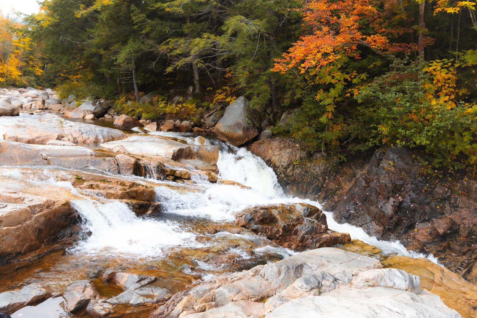
The natural crown of the West River valley
In the north-western corner of Windham County, near the village of Jamaica, Jamaica State Park protects 772 acres of hardwood forest, mountain streams and dramatic bends along the West River. It is one of the most usable outdoor destinations in southern Vermont, and the reason is its shape rather than its size.
The park’s main artery follows the grade of a 19th-century narrow-gauge railroad, which means the West River Rail Trail is flat, wide and smooth for miles directly alongside the water. Strollers, small children, casual cyclists and anyone who does not want to climb can all use it, which is rare in Vermont where most riverside access involves a scramble.
For those wanting more, a spur climbs into the backcountry along Cobb Brook toward Hamilton Falls, a multi-tiered cascade of about 125 feet that ranks among the tallest and most dramatic waterfalls in southern Vermont. And twice a year, controlled dam releases turn the placid West River into a serious whitewater course.
The West River Rail Trail
From 1880 to 1936 the West River Railroad ran from Brattleboro to Londonderry, carrying timber, granite, livestock and passengers through terrain far too steep for comfort. Locals called it thirty-six miles of trouble, on account of constant washouts, derailments and hairpin curves, and the great flood of 1938 finished it off for good.
What it left behind is an ideal trail. The rail bed through Jamaica State Park is packed gravel and earth, essentially level, and it hugs the rocky riverbank with the water in view almost the whole way. Gravel bikes, mountain bikes, trail runners and families with pushchairs all work, and the full trail system extends up to sixteen miles in sections beyond the park.
Salmon Hole, near the park entrance, is the other headline. A wide, deep bend in the West River with a sandy shoreline and calm water, it is one of southern Vermont’s premier summer swimming holes and it is a two-minute walk from the parking area. Water shoes are worth having for the rocks.
The park also has the Overlook Trail, a 2.2-mile round trip climbing 720 feet to a panoramic view over Jamaica village and the river bend — a genuine hike, but a short one, and the best payoff-per-effort in the park.
Hamilton Falls
Leaving the flat rail trail behind, the hike to Hamilton Falls climbs along Cobb Brook into a secluded canyon within the Winhall Municipal Forest.
The route is straightforward. Walk 2.1 miles north on the West River Rail Trail from the park entrance to the marked junction at Cobb Brook. Cross the footbridge and follow the blue-blazed Hamilton Falls Trail for 0.9 miles as it climbs beside the rushing stream. The trail then opens into a natural amphitheatre where Cobb Brook plunges about 125 feet over a series of granite ledges into a pool below. Six miles round trip, roughly 650 feet of gain, moderate.
One warning matters more than anything else in this guide. Do not climb on the rocks and do not swim in the pool at the top of Hamilton Falls. The granite is permanently coated in slick algae, the currents at the lip are far stronger than they appear, and multiple people have died here. Stay behind the safety railings and view the falls from the base area.
Beyond that, the hike is a pleasure: hardwood forest of beech, birch and maple, small stream crossings, and a canyon that feels genuinely remote despite being three miles from a car park.
Whitewater releases and water operations
Twice a year the character of the West River changes completely. The US Army Corps of Engineers conducts controlled releases from Ball Mountain Dam, upstream of the park — typically one weekend during spring snowmelt in late April and one during foliage season in late September.
During release weekends the river goes from a calm mountain stream to a Class II to IV whitewater course, and kayakers and canoeists arrive from across the Northeast to run the rapids through Jamaica State Park. It is one of the biggest paddling events in New England, and even if you are not boating it is worth watching — the drop below the park entrance produces a natural amphitheatre of spectators.
Release dates are published in advance by the Corps and the state parks; they shift year to year with conditions, so check before planning a trip around them. On release weekends the park is crowded and parking fills early.
Outside those weekends the West River is gentle, fishable for trout and bass, and swimmable at Salmon Hole and several quieter bends upstream.
Visitor essentials
What to know before you go.
Park hours — open daily from 10am to sunset, with staff on duty roughly May through October.
Fees — a small day-use charge per adult and child; Vermont state park passes are accepted.
West River Rail Trail — flat packed gravel, up to sixteen miles in sections, suitable for bikes, runners and pushchairs.
Salmon Hole — a two-minute walk from the parking area; sandy shoreline, calm deep water, water shoes recommended.
Overlook Trail — 2.2 miles round trip, 720 feet of gain, moderate, for the view over Jamaica village.
Hamilton Falls Trail — 6 miles round trip, about 650 feet of gain, moderate. Sturdy shoes; do not climb the wet rock.
Camping — tent sites and lean-tos in the park, plus more at Townshend State Park ten minutes south.
Dogs — welcome on a leash no longer than ten feet throughout the park and trails.
Around the park and where to stay
Jamaica State Park sits just off Route 30 at Jamaica village, about forty minutes north-west of Brattleboro and twenty minutes from Stratton. It makes an excellent non-ski day for anyone staying at Stratton or Mount Snow, and a good half-day for anyone driving Route 30 between Brattleboro and Manchester.
Ten minutes south, Townshend has the Scott Covered Bridge — Vermont’s longest single-span covered bridge at 277 feet — plus Townshend State Park with camping and the hike up Bald Mountain. Newfane’s Greek Revival green is twenty minutes south, and Grafton’s restored village and cheese company thirty minutes east. Stratton and Bromley are twenty and thirty minutes north-west for skiing.
Summer is the season here — the river is warm by July, the swimming is good and the trail is at its best. Foliage in the first half of October frames the river valley and coincides with one of the dam releases. Winter closes the campground but the rail trail takes snowshoes and fat bikes, and mud season in April makes the upper Hamilton Falls trail unpleasant.
For lodging, Jamaica and Townshend state parks offer camping and lean-tos in season; Stratton and Mount Snow have slopeside options twenty to forty minutes away; the historic Grafton and Newfane inns give a quieter, more atmospheric base; and Brattleboro, forty minutes south-east, has the widest choice and the best value. Compare live prices in the search below, with free cancellation on most rooms.
Good to know
Common questions
How tall is Hamilton Falls?
About 125 feet, dropping in tiers over granite ledges on Cobb Brook, which makes it one of the tallest waterfalls in southern Vermont. It is reached by a six-mile round-trip hike from Jamaica State Park.
How do you hike to Hamilton Falls?
Walk 2.1 miles north on the flat West River Rail Trail from the Jamaica State Park entrance to the marked Cobb Brook junction, cross the footbridge, then follow the blue-blazed trail 0.9 miles uphill beside the stream. Six miles round trip with about 650 feet of gain.
Is it safe to swim at Hamilton Falls?
No. Do not climb the rocks or swim in the pool at the top. The granite is permanently coated in slick algae, the currents at the lip are far stronger than they look, and multiple people have died there. View the falls from the base area behind the railings.
What is the West River Rail Trail?
A flat, packed-gravel path following the grade of the West River Railroad, which ran from 1880 to 1936 and was nicknamed thirty-six miles of trouble. It runs level alongside the river through Jamaica State Park and extends up to sixteen miles in sections, suitable for bikes and pushchairs.
When are the West River whitewater releases?
Twice a year, when the Army Corps of Engineers releases water from Ball Mountain Dam — typically one weekend in late April during snowmelt and one in late September during foliage. The river becomes a Class II to IV course and draws paddlers from across the Northeast. Check dates in advance.
Every booking through Vermont Destinations funds one verified tonne of carbon removal — same room, same price, no markup.
Find a stay